North End: Self-Guided Tour
The North End is the city's oldest residential community, where Europeans have continuously lived since the area was settled in the 1630s. Although immigrants were not exclusively Italian, the neighborhood grew into Boston's "Little Italy," and has popular Italian restaurants lining the streets.
Take a stroll through the narrow streets of this charming neighborhood to feel transported centuries back. Get a taste of Italy with a delicious pasta meal, and finish on a sweet note with a treat from the local bakery.
Follow the path along the numbered stops on the map from start to finish. The guide below talks about the story behind each stop. You will visit famous locations such as the Old North Church and Copp's Hill Burying Ground, as well as quieter and lesser-known parts of the North End where tourists rarely venture.
1. Rose Kennedy Greenway
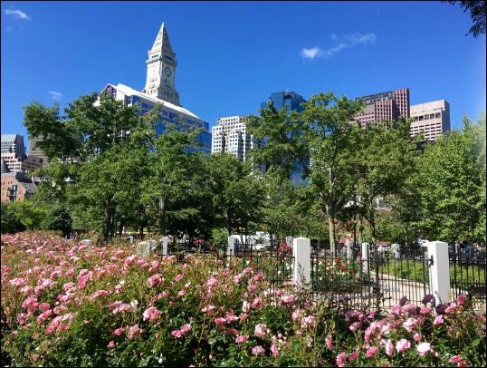
A modern park with breathtaking views of both the Boston skyline and the North End. The area was dominated by an elevated highway until a $22 billion project called the Big Dig moved the highway underground, creating the Rose Kennedy Greenway in 2006.
The Greenway marks the border to the North End. Before the Big Dig, crossing into the North End required passing under the unsightly bridge, effectively isolating the neighborhood from other communities nearby. Now, entering the North End is just a pleasant walk across the Greenway, opening up the neighborhood for tourists and city residents alike.
2. The Paul Revere House
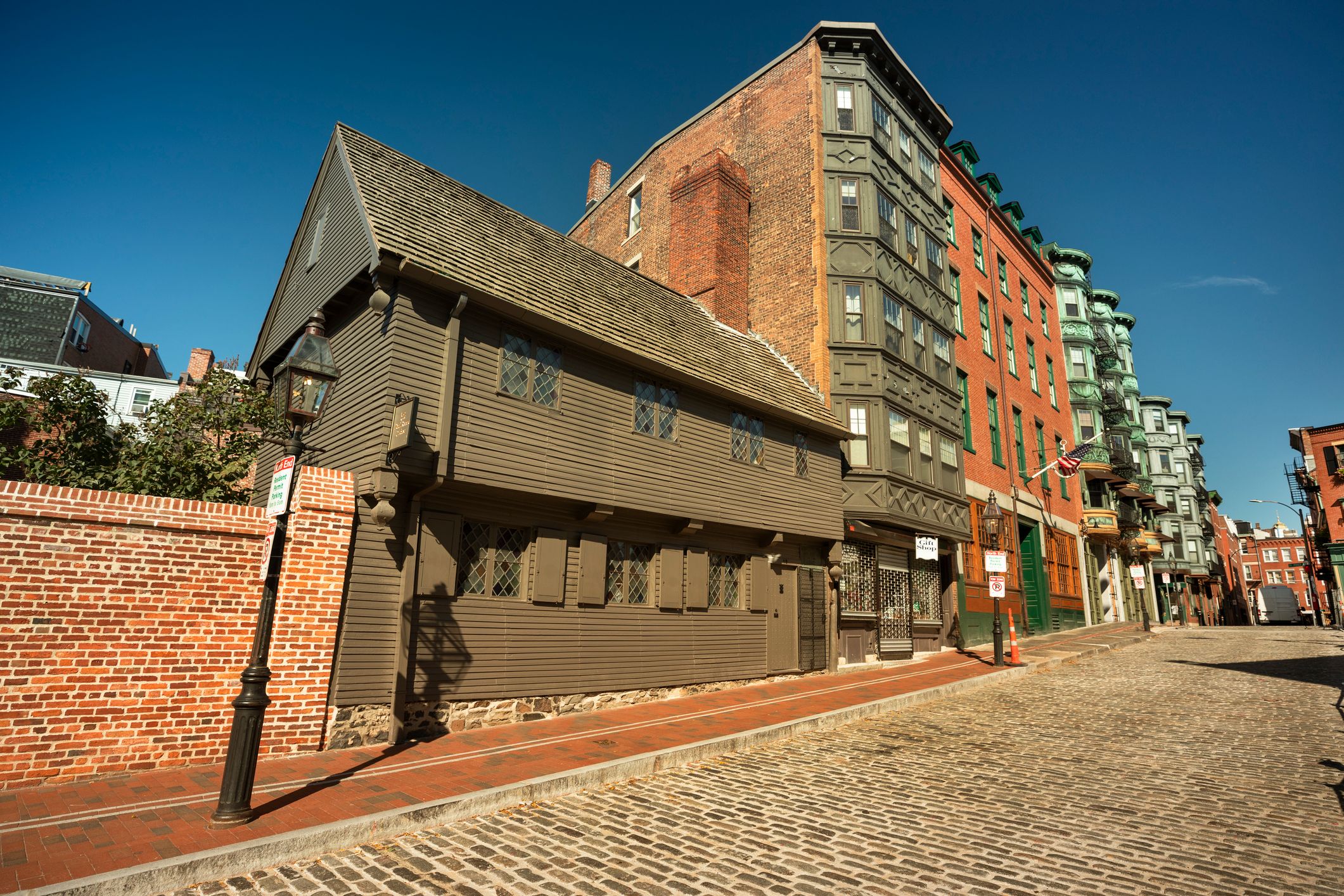
One of the oldest wooden houses in Boston, the Paul Revere House was built in 1680. Paul Revere purchased it in 1770 and lived here with his first wife Sara, five of their children, and his mother Deborah. Revere would eventually have 16 children, 11 of whom survived into adulthood.
The house reflects how homes were built in early Boston. Firewood was scarce and expensive on the peninsula, so houses were designed to keep heat in: low ceilings, small windows with shutters, and dark paint to absorb sunlight. Every house on North Square once looked like this, but a series of "Great Fires" destroyed most of the original wooden buildings.
Next door is the Pierce-Hichborn House, one of the oldest surviving brick houses in Boston, built in 1711.
We will learn more about Paul Revere and his famous midnight ride at a later stop on the tour.
3. North Square
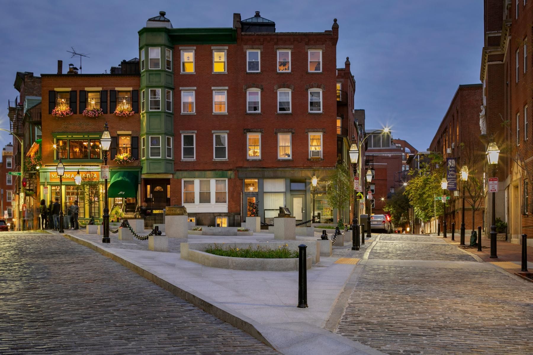
North Square is one of the oldest public squares in the United States, and has been continuously occupied since at least the 1630s. Formerly known as Clark Square, it has been a community gathering place and bustling market area for nearly four centuries. Paul Revere's house, the oldest wooden building in downtown Boston, faces the square.
The square is currently used for outdoor dining by multiple surrounding restaurants. Enjoy a lovely Italian meal with a stunning view of the North End skyline.
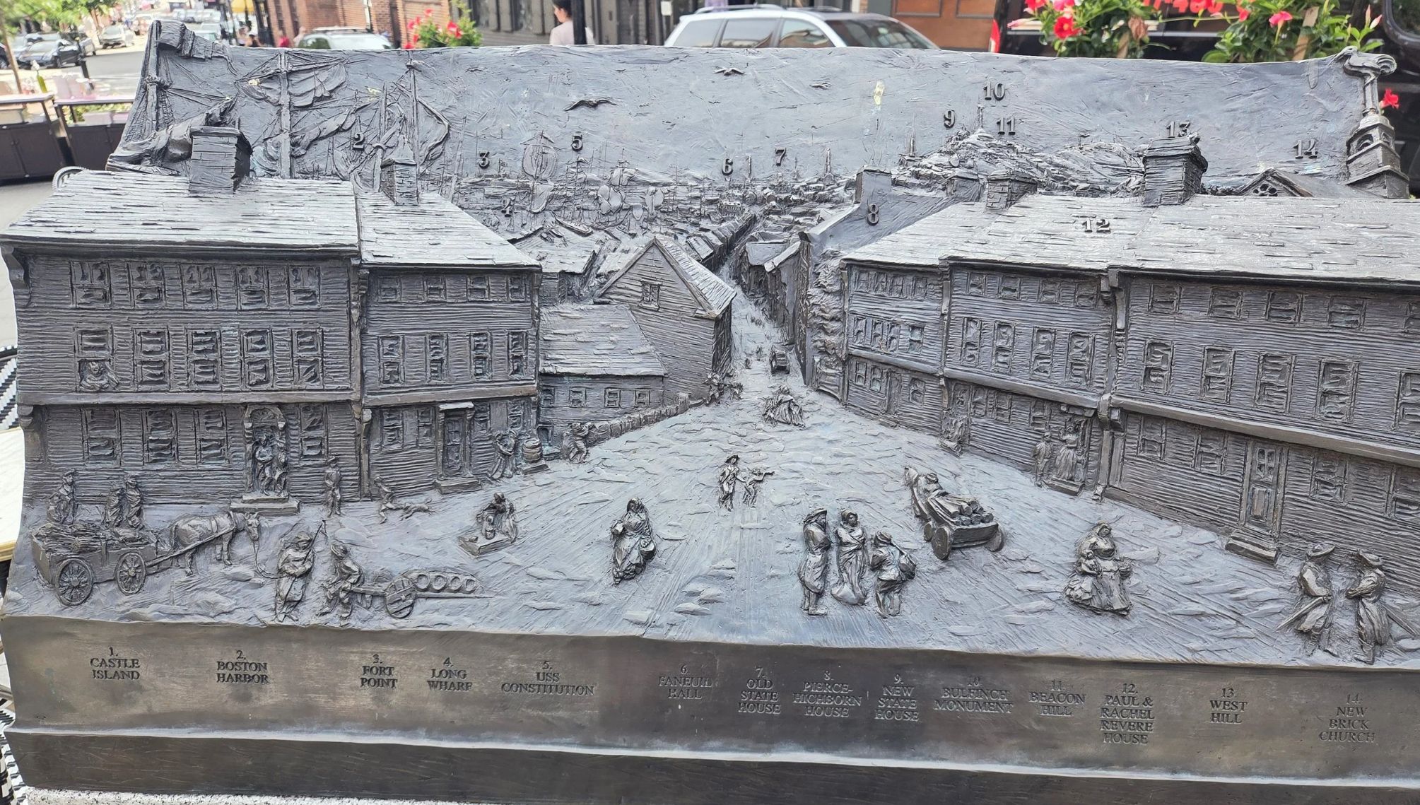
4. North Square View in 1798
1798 North Square View is a historically accurate panoramic view from North Square in the year 1798. The sculpture dramatizes the integration of wharves, streets, masts and steeples, and highlights Boston’s topography when the city was on the eve of rapid development and land-making that significantly leveled the prominent three hills (tres-mont) of the city and lowered Beacon Hill by 60 feet.
The index along the bottom edge labels some of the features that would have been visible from this spot in 1798, including Faneuil Hall, the Old State House, Paul Revere House, Pierce-Hichborn House, Beacon Hill and the new State House, Long Wharf, Fort Point, Castle Island, West Hill, and more. Some of these landmarks are still visible from here today, some are obscured by new buildings, and some are gone. Which of them can you see?
Some things to look for in the sculpture:
Someone filling water jugs at the town water pump The Old Cockerel (New Brick) Church steeple A horse and carriage Pigeons on a rooftop Paul and Rachel Revere A youngster with a spyglass Someone watching the street from their window USS Constitution at dock A dog Crow’s nest Dorchester Heights The Neck A shortcut down to the waterfront Old Feather Store (1680–1860) at Dock Square Redcoats
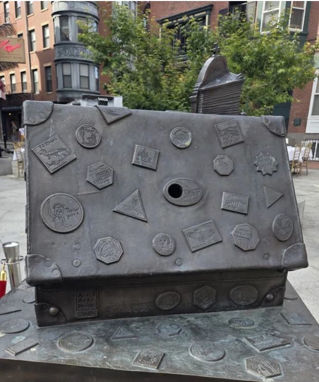
5. What We Brought With Us
What We Brought With Us honors the North End as a gateway to the City of Boston for innumerable immigrant groups, most recently Italians. The suitcase is bursting with traditions and customs brought here by immigrants over the centuries.
Inside the suitcase a North End feast procession fills the streets of North Square in front of Sacred Heart Church. The patron saint is carried aloft through the crowds. Some residents watch the scene from their windows.
Around on the right side of the sculpture, a larger-scale scene depicts the interior of one of the North End’s hundreds of tenement flats that were lived in by the many immigrant families who arrived here from different countries around the world. Peering through the window as though watching the scene in the street below, you glimpse a distant harbor and steam ship ready to depart for a new land.
The suitcase is covered with luggage labels which were drawn by students from two North End schools: St. John School on Moon Street near North Square and Eliot School. Labels were also created by students from the greater Boston Menotomy Rocks Homeschool Coop. The labels represent the diverse backgrounds and various places of origin of the people of the North End.
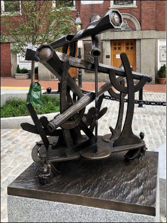
6. Fantastical Historical Nautical Instrument
Fantastical Historical Nautical Instrument is derived from nautical navigation instruments, and its triangular sextant-like base echoes the triangle of North Square. The sculpture is covered in elaborate scroll work reminiscent of scrimshaw, an ancient art practiced by whaling seamen during their long voyages. But whereas a marine sextant is used to measure space, this instrument instead surveys time, with an assemblage of scopes offering imaginary views into stories from the past. Each scope contains what looks like an abstract pattern, but when you peer through the scope’s eyepiece a coherent picture is revealed. The abstract patterns are a kind of distortion called oblique anamorphism which appears correct only when seen from a specific angle, to which the scope eyepieces are appropriately set.
The five scopes in the sculpture hold anamorphs of these North Square stories:
Sarah Josepha Hale (1788–1879), Founder of Seaman’s Aid Society (1833) and Mariners House (1847) in North Square. She was a writer, poet, activist, editor, and advocate for women, the poor, and minorities; she authored “Mary Had a Little Lamb.” She was also the main force behind Thanksgiving becoming a national holiday. Onesimus (late 1600s–1700s, dates unknown), an African man held as slave by Cotton Mather, he introduced Mather to an African inoculation process which was used in smallpox-stricken Boston in 1721 and laid the foundation for the development of vaccines. Reverend Edward Thompson Taylor (1793–1871) of Seamen’s Bethel, now Sacred Heart Church in North Square. “Father Taylor,” as he was affectionately known, was admired by Ralph Waldo Emerson, Walt Whitman, Charles Dickens, and the 19th century Swedish opera singer Jenny Lind. It is said that Herman Melville based his character Father Mapple in the novel Moby Dick on Rev. Taylor. John “Honey Fitz” Fitzgerald (1863–1950), US representative, mayor of Boston and North End resident, and Rose F. Kennedy (1890–1995) who was born just a few steps away from here. There is a memorial plaque on her house in Garden Court Street. SS Andrea Doria, an Italian ocean liner wrecked in a collision off Nantucket in 1956, one of the worst maritime disasters in US history. The scope aims towards the site of the disaster.
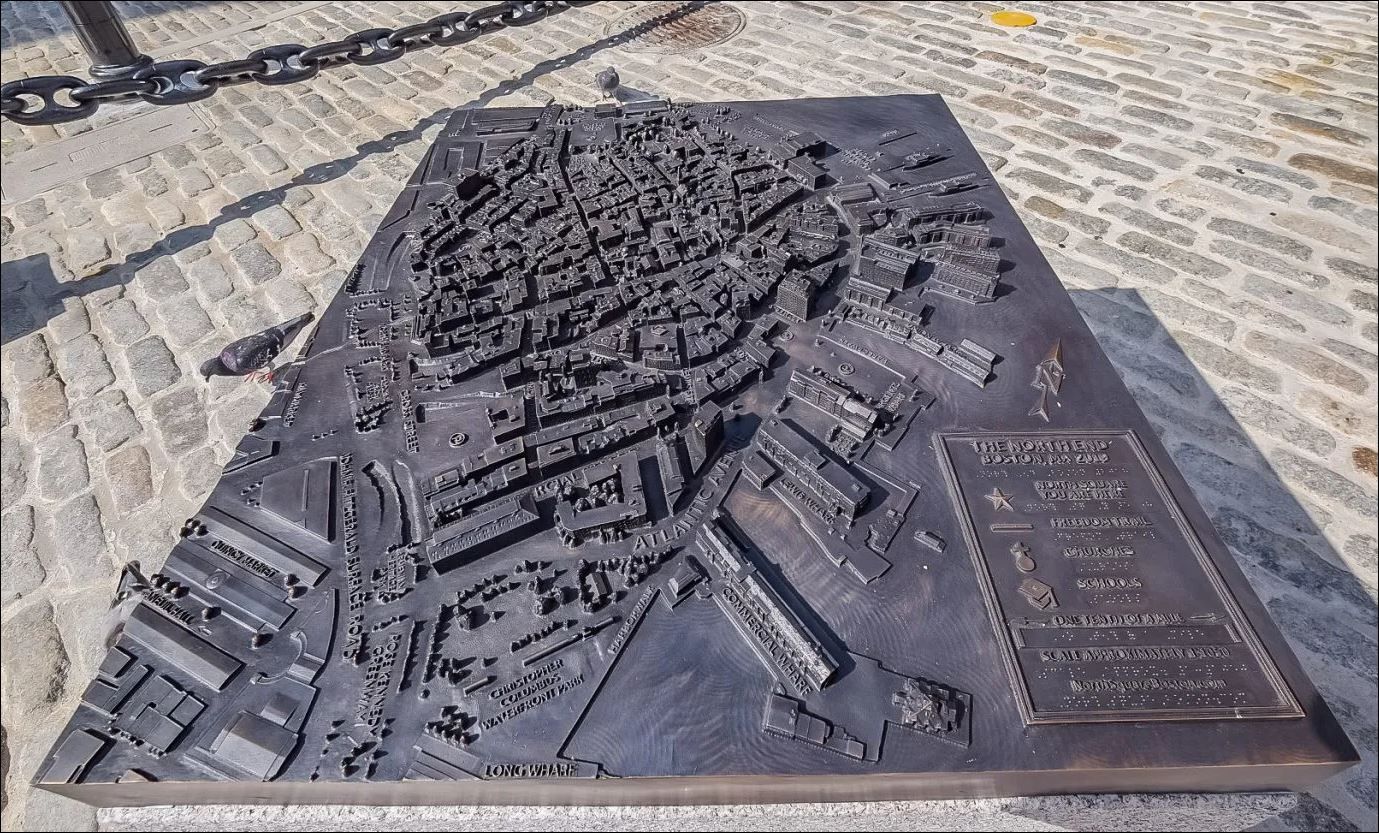
7. North End Story Map
North End Story Map depicts the North End neighborhood in 2019, an area slightly larger than a third of a square mile with a population of 10,000.
Treasure hunt in North End Story Map. See if you can find these hidden objects:
- Two cannoli
- Three garlic cloves
- Challa bread at the site of kosher bakeries
- 2019 US penny at the site of the Great Brinks Robbery
- Shamrock at the site of Bridget Clougherty’s house, swept away in the - Great Molasses Flood of January 1919
- Bell at the site of Paul Revere’s brass and iron foundry (1787)
- New England Patriots team logo
Other things to look for in the map:
- Old North Church
- Copps Hill Burying Ground
- North Square star
- Constitution Wharf, site of Edmund Hartt’s shipyard where USS Constitution was built in 1797
- Armenian Heritage Park
- “The Gassy” playground, site of the giant gasometer storage tank
- Paul Revere equestrian sculpture by Cyrus Dallin (1940)
- Tunnel entrance ramps
- Merry-go-round on the Greenway
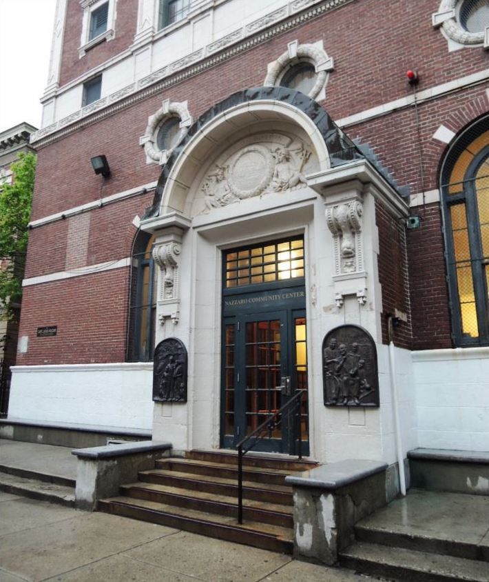
8. Nazzaro Community Center
The Nazzaro Community Center Bath and Gymnasium (formerly known as the North Bennet Street Public or the North End Bath House) is one of the last remaining grand public bath houses, situated at the heart of Boston's oldest neighborhood.
Many of the early tenement houses in the North End didn't have baths or showers, forcing the residents to rely on a public bathhouse. The building evolved into a community center and a popular meeting place for after-school programs, seniors, community meetings, holiday parties and voting for over 100 years.
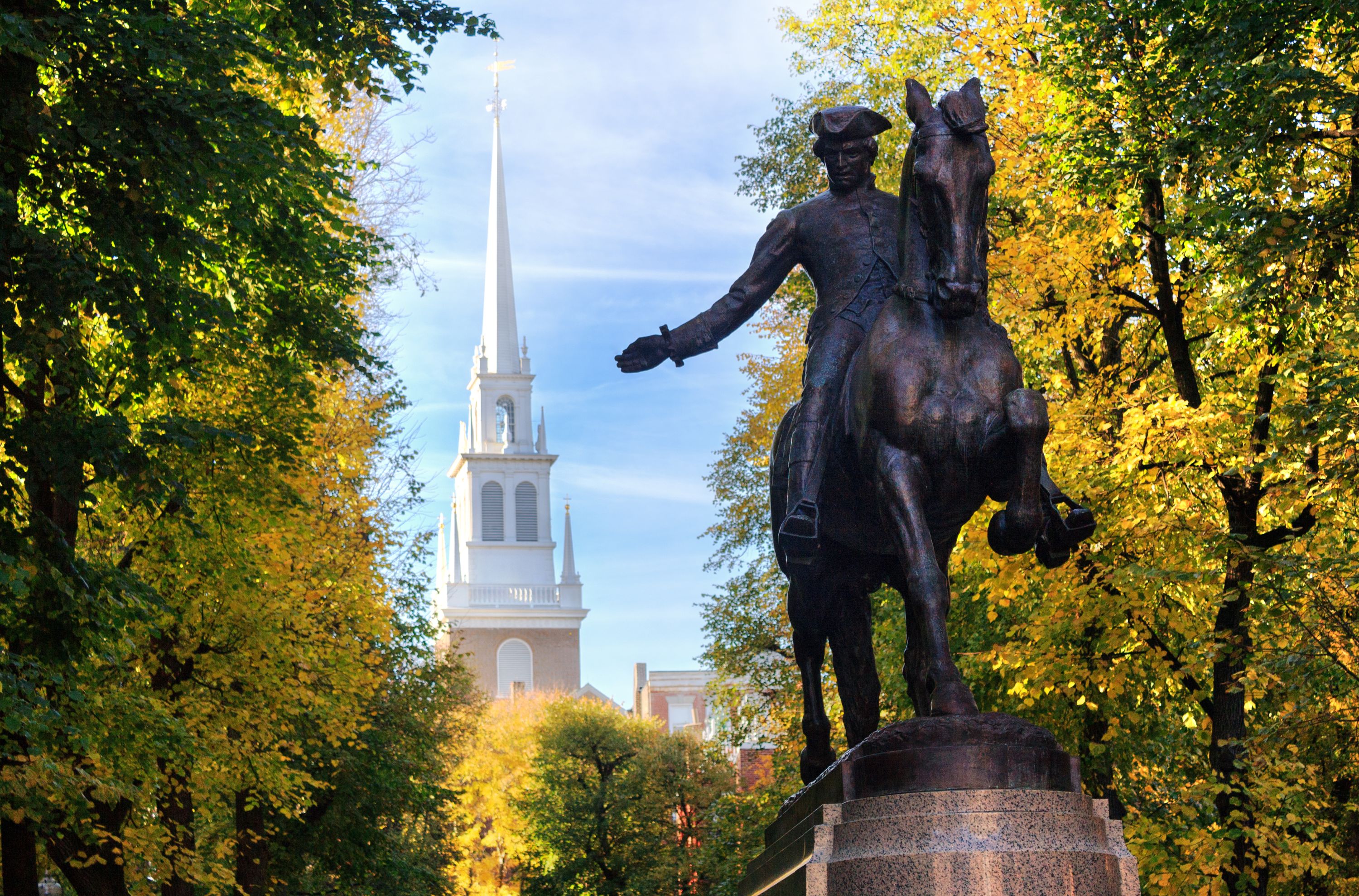
9. Paul Revere Statue
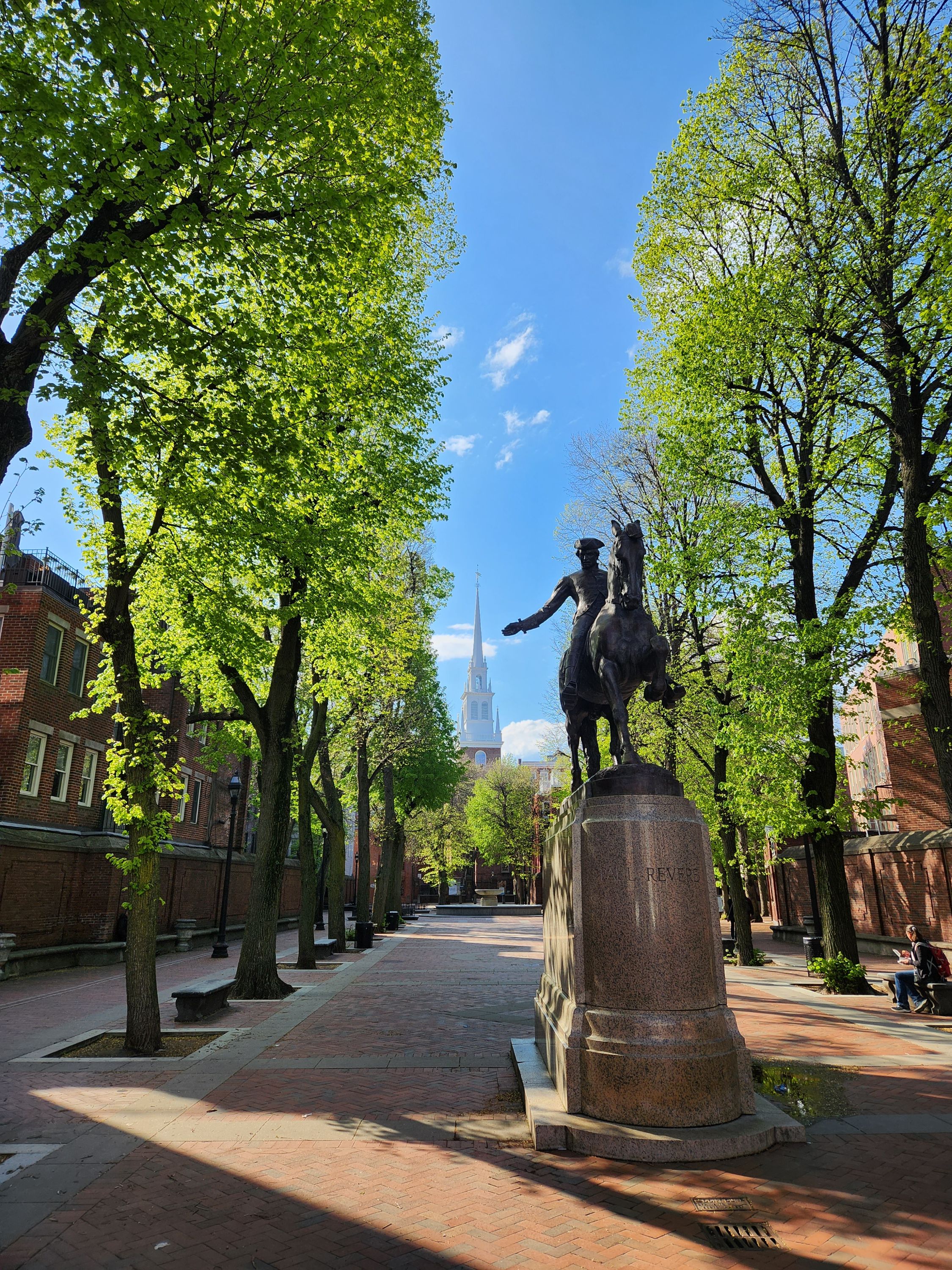
A statue commemorating Paul Revere's midnight ride stands at the entrance of the beautiful Paul Revere Mall. The Old North Church and the tree-lined park provide a perfect Revolutionary backdrop for photos during the day or night, summer or winter.
Don't miss the beauty of the rest of this small urban oasis. The Paul Revere Mall, inspired by the Paseo del Prado in Havana, was built to create a direct sightline between two historic landmarks: The Old North Church and St. Stephen's Church.
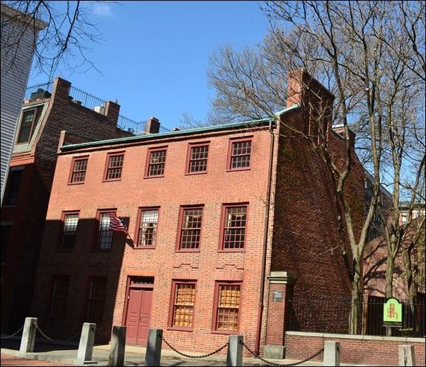
10. Clough House at Old North
The Clough House was built around 1715 by master bricklayer Ebenezer Clough as a home for himself and his family. It is a rare example of a surviving brick rowhouse and is one of the oldest buildings in Boston.
Clough was a master bricklayer who built the Old North Church that currently stands adjacent to the Clough House. The original "work from home"!
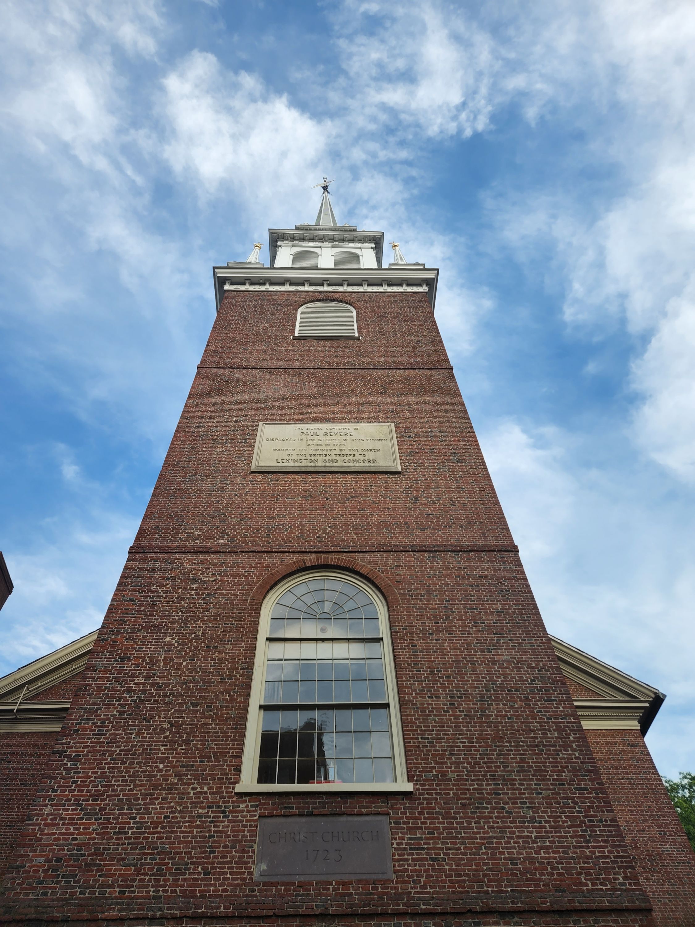
11. Old North Church
The steeple of this church is where the famous lanterns were hung by Paul Revere's compatriots before his midnight ride to warn people that the troops from Britain were approaching and the war was starting.
This ride was the origins of the famous poem that commemorated the phrase "one if by land, two if by sea." One lantern was to notify Charlestown that the British Army would march over the Boston Neck and the Great Bridge, while two lanterns would notify them that the troops were taking boats across the Charles River.
The lanterns were hung in the steeple windows for just under a minute to avoid alerting the occupying British troops, although this was enough time for the Charlestown Patriots to notice the signal.
Today, the church is an active Episcopal Church with congregations every Sunday.
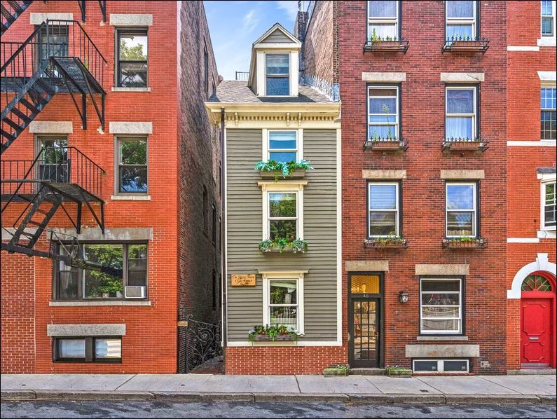
12. Skinny House
Please note that this is an active home, not a museum, so please be polite and refrain from peering in the windows.
This narrow four-story house, squeezed between two generic townhouses, has the "uncontested distinction of being the narrowest house in Boston." Also known as the Spite House, the origins behind the unusual architecture are unclear. There are two common legends, and one story, that, while unexciting, is likely the closest to the truth.
A story of two brothers: Two brothers inherited land from their deceased father. While one brother was away serving in the military during the American Civil War, the other built a large home, leaving the soldier only a shred of property that he felt certain was too tiny to build on. When the soldier returned, he found his inheritance depleted and built the narrow house to spite his brother by blocking the sunlight and ruining his view.
A tale of the typical Boston temper: Legend has it that an unnamed builder erected it to shut off air and light from the home of a hostile neighbor with whom he had a dispute. Believed to have been built after 1874.
The likeliest true story: This house was once part of a larger structure. The rest of the building was demolished for the larger brick houses that stand next to it today, and the Skinny House, for whatever reason, was left behind.
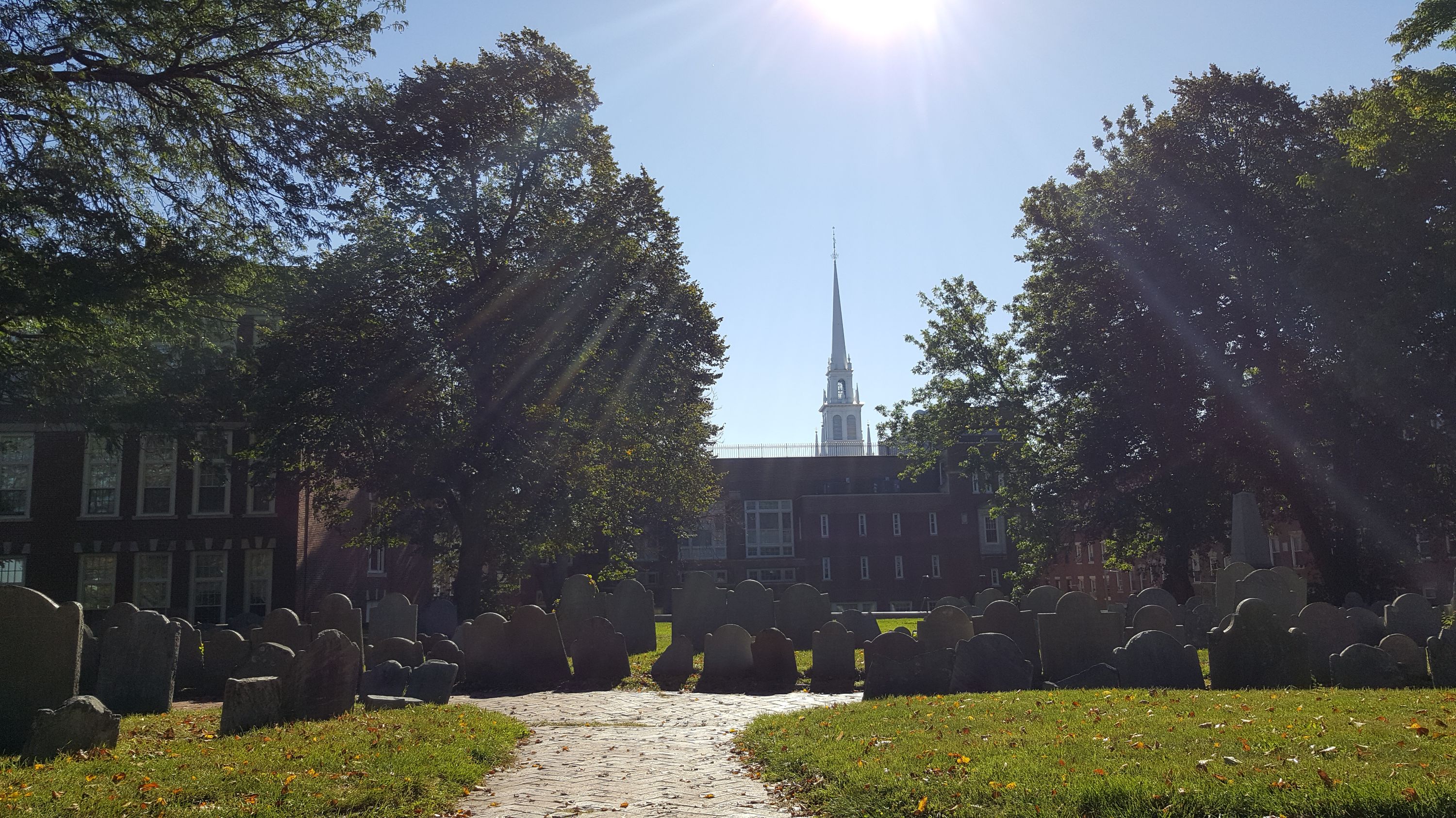
13. Copps Hill Burying Ground
The next three stops all take place in the Copp's Hill Burying Ground. Note that Copp's Hill closes at 4pm each day, so if you reach this point after that time, you will be unable to visit the next three stops, although we encourage you to still read about them!
Copp's Hill was Boston's largest colonial burying ground. It is the second-oldest burying ground in the city, with records dating it to 1659. Named after shoemaker William Copp, the Burying Ground is the final resting place for merchants, artisans, and craftspeople who lived in the North End, as well as revolutionaries.
Because of its height and panoramic vistas, the British used this vantage point to train their cannons on Charlestown during the Battle of Bunker Hill in 1775.
14. Daniel Malcolm Tombstone
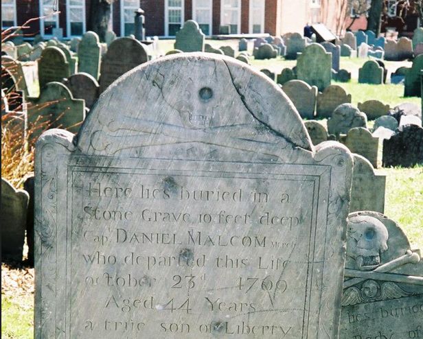
North End resident and member of the Sons of Liberty, Capt. Daniel Malcolm’s claim to fame is smuggling 60 casks of wine without paying the duty on it.
Buried, as noted on his marker, "...in a stone grave 10 feet deep...", Malcolm feared the British would dig up his body for nefarious purposes. While Malcolm himself is safe 10 feet below, his tombstone is riddled with bullet holes. Legend has it that British soldiers would read his epitaph, spit on his grave and then fire at his marker for luck in battle.
15. Prince Hall Gravesite
"The Forgotten Founding Father"
A small community of free African Americans lived on the steep slope of Copp's Hill from the 17th to the 19th century. More than 1,000 of them may be buried in Copp's Hill Burying Ground, primarily in the northwest corner, in the area along Snow Hill Street that has fewer surviving gravestones. The lack of stones may be because the stones were removed or lost, or the memorials were made of wood that has since decayed. The local free African American community started about 1650, when a small number of slaves gained their freedom.
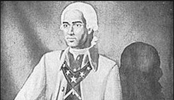
Prince Hall (c. 1735-1807) One of the more notable people buried in this area is Prince Hall, who "was one of the most influential free Black leaders in the late 1700s," and was sometimes referred to as the "forgotten founding father."
After being freed from slavery at the age of 35, he assumed a leadership role in the African American community. He left a legacy of activism and fighting for equality:
- Drafting petitions for the abolition of slavery
- Protesting the slave trade and objecting to the exclusion of African American children from schools
- Actively speaking out against the kidnapping of free Black men from Boston
- Founding the African Lodge of the Honorable Society of Free and Accepted Masons of Boston, the first lodge of black Freemasonry
When he died, it appears that he was buried near his first wife, Sarah Ritchie, as his name is inscribed on the back of her grave marker.
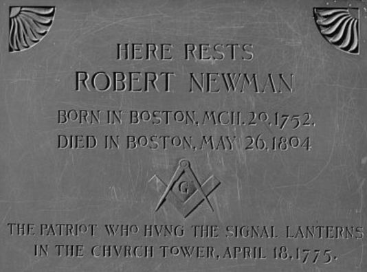
16. Robert Newman Headstone
Robert Newman was one of the men responsible for putting up lanterns in the Old North Church steeple to signal to other Patriots that the British have begun their march to Concord on April 19th, 1775.
"One if by land, two if by sea" was the signal, pre-arranged by Paul Revere. The signal was intended for messengers waiting outside of the Boston peninsula, who proceeded to spread the "Lexington Alarm" throughout nearby towns.
The signal was spotted across the river and allies began spreading the word. British Regulars also witnessed the display and encircled the church. According to local legend, Newman escaped out a back window of the church and fled for home. General Thomas Gage arrested him the following day, April 19, yet nothing could be proven against Newman, and he was released three days later.
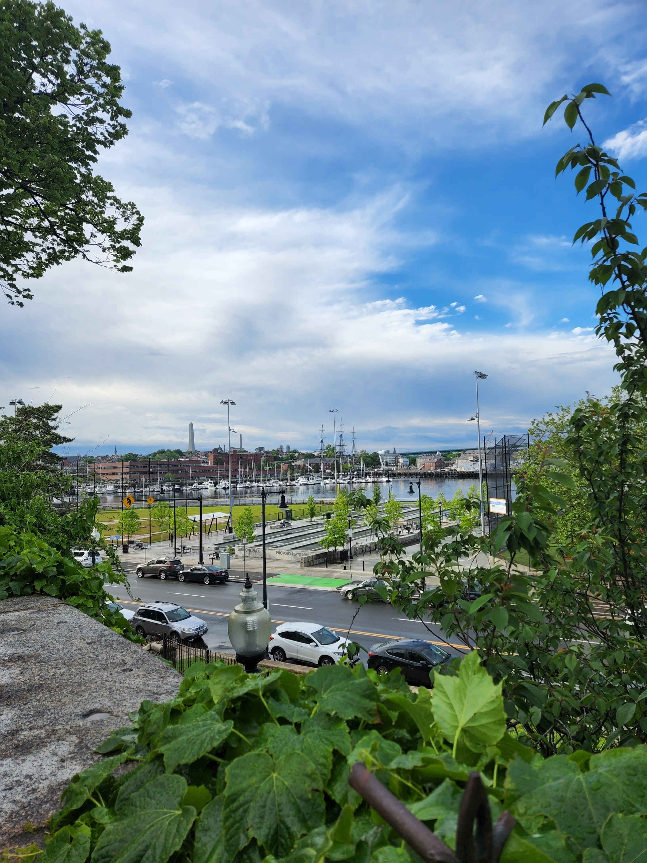
17. Copp's Hill Terrace
Take a short break in this cool shaded urban retreat while you take in views of Charlestown, Bunker Hill Monument, and the marina across the bay.
By the 1890s, the North End was one of the most densely inhabited urban districts in the United States, packed with tenement buildings and many shops. Through the urging of councilman (and future mayor) John "Honey Fitz" Fitzgerald, Copp's Hill Terrace was built as the largest open space in this teeming district. However, the architect in charge of the job was not as elated as residents. After designing the terrace, Charles Eliot wrote in sadness to his wife in 1895 that Copp's Hill Terrace provided a recreation retreat for "the slum people . . . unclean beings, children pushing everywhere and swarming in every street and alley".
A few decades later, a large crowd observed the destruction wrought by Boston's Great Molasses Flood of 1919 from the safety of this very terrace.
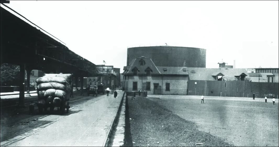
18. Great Molasses Flood Plaque
Where the bocce courts are located today used to be a 2.3 million-gallon tank used to store molasses. The tank was badly designed, and even the engineer who was paid for the job didn’t want to build it. On January 15, 1919, temperatures in Boston had risen above 40 degrees, and there was a new shipment of molasses that filled the tank. Due to the tank being badly designed and not well tested to hold all of the 2.3 million gallons of molasses, it overheated and burst. A wave of molasses up to 20 feet tall swept the neighborhood, killing 21 people and injuring 150. The molasses quickly crystallized, trapping anyone still alive inside. While people tried to pull the survivors out of the molasses, it was too late due to the crystallization of the syrupy liquid, and as a result, mostly only limbs came off. The event entered local folklore, and residents reported for decades afterward that the area still smelled of molasses on hot summer days.
The company tried to blame the disaster on Italian anarchists, but ultimately it was found liable and fined one million dollars. This ushered in a new era of regulation and oversight in the US generally and Boston specifically.
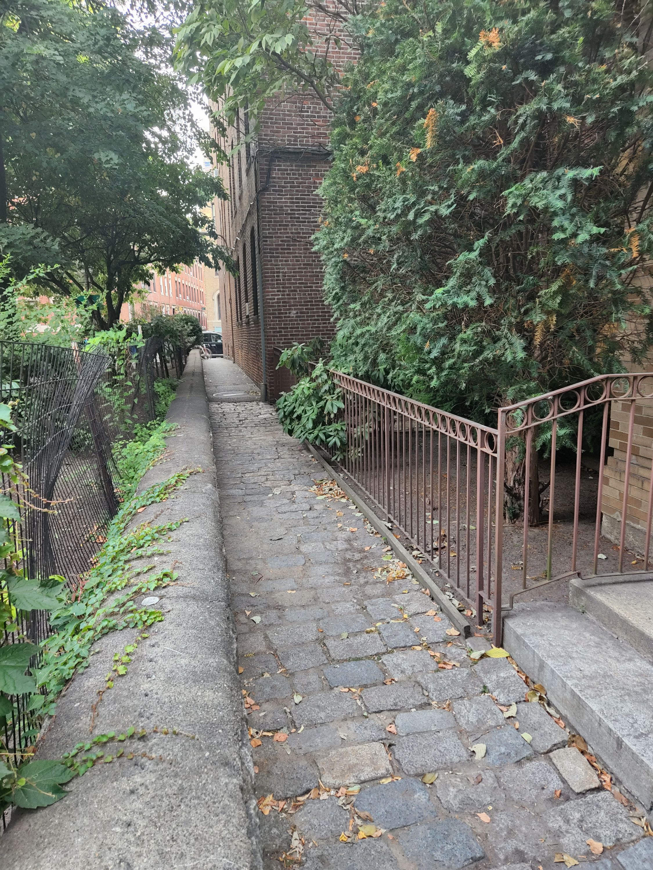
19. Greenough Lane
Walk down Greenough Lane, one of the skinniest and oldest streets in Boston. Proceed down the half-paved, half-cobblestone alley to reach Charter Street Park, one of Boston's best urban parks tucked away in a quiet part of the North End.
This quiet park is a great spot to enjoy a cup of coffee and take a breather. The flowers are planted by local school children from the Eliot School across the street. Look out for the lower level gardens around the park.
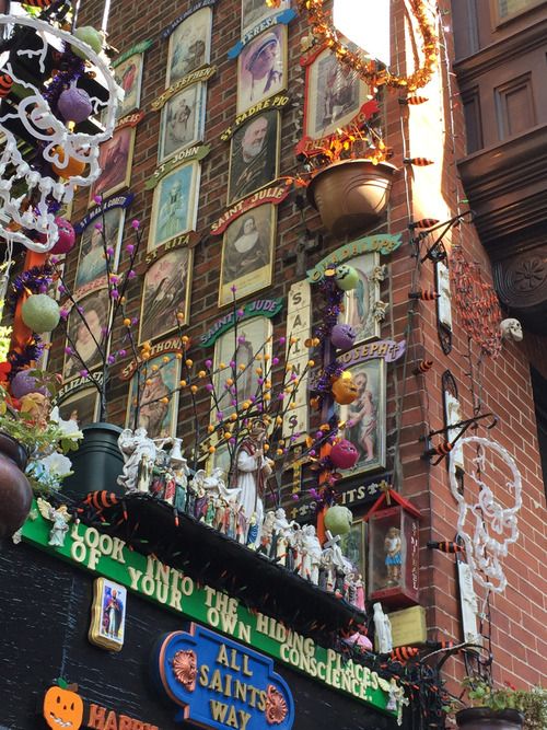
20. All Saints Way
Nestled in the North End of Boston, this alley is called All Saints Way. Behind an iron gate you can see the Wall of Saints: portraits ascending up the exterior brick wall of the adjoining building.
This private collection has grown into a street-side shrine, with a display of the canonized including photos, statues, prayer cards, and tribute to Roman Catholic saints.
While the shrine is a personal project on private property, the owner, Peter Baldassari, was known to give quick tours before he passed in 2025. A group of volunteers now maintains it, and if you get lucky, one may let you in! A good portion of the collection is visible from the street, even if the gate is locked.
21. Battery Wharf Coast Guard Museum
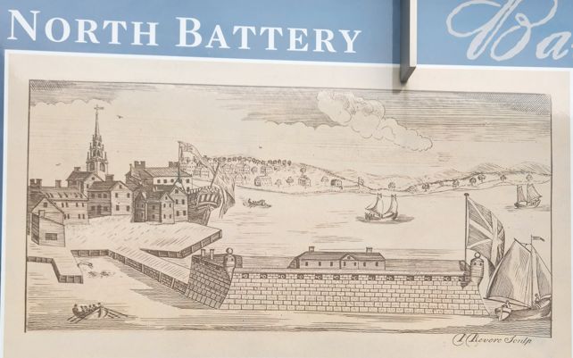
This free pocket museum documents Battery Wharf's maritime history. In 1646, a shoreline battery was built here to protect the mouth of the Charles River and cover Boston Harbor. On June 17, 1775, more than half the British soldiers who attacked Breed's Hill departed from this wharf.
Features a seating bench made from live oak, the special
The museum’s exhibits include archival photos and information on:
- The Battery Wharf Story
- The Shipbuilding and Live Oak Connection Industry on the Waterfront
- Birthplace of the Coast Guard
- Trains and Ferries
- Off to War
Free admission • Open daily until 9pm
Water Taxi Outside the Museum is a waiting area for the water taxi stop. A unique (although somewhat pricey) way to get around Boston, Boston Water Taxis stop at nearly 20 points around Boston Harbor. It is not a regularly-scheduled service; you must pre-book to be picked up.
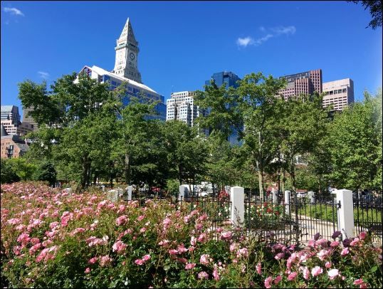
22. The Rose Kennedy Rose Garden
This secluded space honors America's Gold Star Mothers as well as Rose Fitzgerald Kennedy, mother of President John Fitzgerald Kennedy.
American Gold Star Mothers is a veterans' service organization that provides support for mothers whose child was lost in the line of duty while serving in any branch of the US Military.
Mrs. Kennedy became a Gold Star Mother on August 12, 1944, the day her oldest son, Joseph Patrick Kennedy Jr. was lost in action when his airplane exploded over the English Channel.